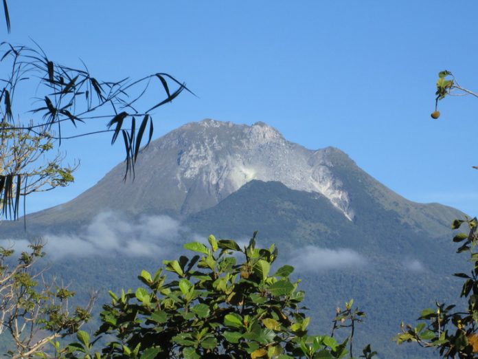
The original idea was simply to climb Mt. Apo. It was an unchecked item on my bucket list. When I knew that we were taking the Sibulan trail, I felt a bit hesitant. I wanted to take easier trails. When I finally gathered the courage to take the challenge, it slowly dawned on me the idea of bringing the violin and playing it at the summit of the mighty mountain.
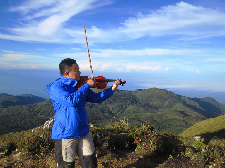
And so, on the third day of our four-day trek, I made history, modesty aside. At 6:12 in the morning of October 30, 2017, at 10,311 feet above sea level, at the country’s highest peak facing Davao Gulf, I played the main theme song of “The Last Mohicans” movie. It was followed by “La Golondrina”, a song about migrating swallow closely associated with exiled Mexicans. What I did was my paean for the spirits believed to be dwelling in the mountain. I had to ask their permission through a silent prayer murmured between my cracked lips to allow me celebrate through solemn music the continued regeneration of the country’s most popular national park. Mt. Apo is considered sacred by the indigenous people living within the 64,000-hectare landscape located in the provinces of Davao del Sur and North Cotabato.

Danilo Bacus, founding president of the Mountaineering Federation of Southern Mindanao (MFSM), cannot recall any other person who ever played the violin at the peak. He served the federation for three terms, spanning six years. He is presently organizing outdoor events and is intermittently tapped by local government units to help them develop outdoor activities for adventure tourism. Julius Paner, the Municipal Tourism Officer of Sta. Cruz, Davao del Sur, also confirms the same. The boulder face trail leading to the peak begins at Brgy. Sibulan in Sta. Cruz town. It is considered as the most dangerous. The boulder face alone is four kilometers long. The Department of Tourism – Davao Region regularly conducts the 95.1-kilometer Mt. Apo Boulder Face Challenge every April.
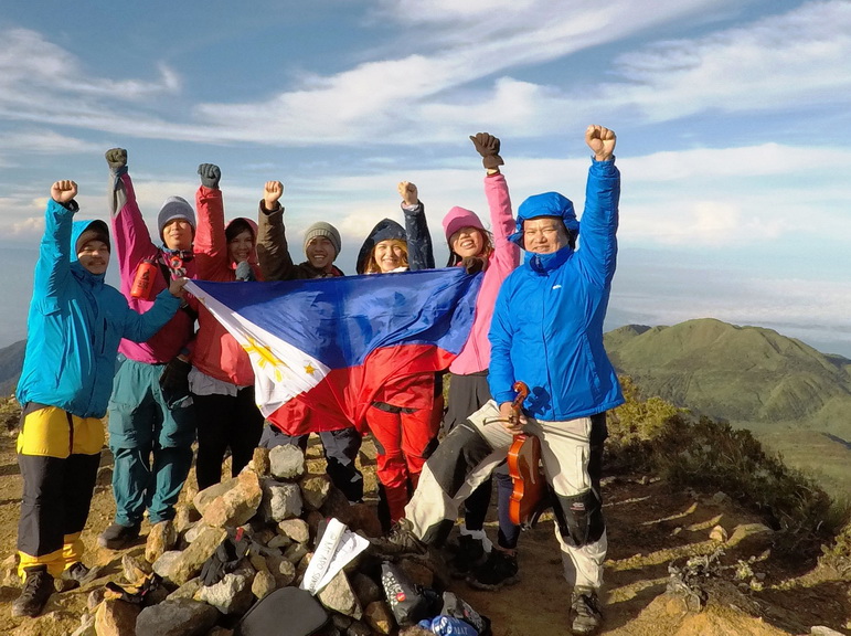
We were seven in the group, which included my cousin Jill Jasmine Gramo, Jan Louis Gramo and Wendy Cuevas (all Australia-bound Filipino chefs); Dave Adrian Cuevas and Lordelyn Villanueva, a computer engineer and school teacher, respectively, from Laguna; and Archie Shirard Roco of South Cotabato. The trip was organized by professional tour guide Terrence Galido of Davao City. We were ably assisted by our ground tour guide, Bboi Ngojo, and three local porters.
 We left Davao City at 4:00 in the morning of October 28, and started trekking the mountain from the jump off station near Sitio Baruring, Sibulan at 8:00 AM. We spent our first night at Tinikaran Holding Camp 1 in the middle of the forest. The second day was more difficult, involving the highly rigorous four-kilometer hike among the big and sharp boulders that took us, ordinary hikers, more than four hours to complete. The weather condition was volatile most of the time. One minute we had crystal clear skies and could clearly see the communities down below. The next minute, we were covered by thick fog and drenched in heavy rains and could hardly see my fellow trekkers 20 meters away from us. The arduous trek along the deep ravine with sulfuric vents oozing harmful fumes makes the Sibulan trail as the most dangerous leading to the summit. We spent our second night at the White Sand, a holding area just below the summit. The following day, we endured the 87-degree vertical climb to the crater lake and the summit. Considering the rainy season, we were gifted with not-so-common super clear skies lasting several hours at the peak. From 10,311 feet above sea level, the sunrise unfolded before our eyes the grand landscape of Davao region, including Samal Island. We had the same exhilarating visual feast when we transferred to another summit facing Lake Venado and the geothermal plants in Kidapawan City.
Presently, there are large portions of the national park which are still off-limits to the public. These are the areas burned down early last year by allegedly irresponsible climbers that caused the massive forest fire, destroying the wild landscapes covering hundreds of hectares. The new growths, particularly the grasses and the wild berries, are testament to the enduring will of nature in healing itself.
This coming November 21-22, I will be assisting the conduct of a workshop organized by the Deutsche Gesellschaft für Internationale Zusammenarbeit (GIZ) GmbH, the German federal funding agency. The GIZ-funded Conflict Sensitive Resource and Asset Management (COSERAM) Program is bringing together all the seven local government units around the national park in an attempt at harmonizing management plans and policies for ecotourism activities in Mt. Apo and sustainable utilization of its resources. Big strides has been made so far, given more stringent policies regarding allowed activities and carrying capacity.


