Last May, Science Secretary Renato U. Solidum, Jr. said there was a 62% chance of going through La Niña by June.
“The 62% by June refers to the probability of experiencing La Niña in the next six months. So, it means that the effects of La Niña may not be immediately evident in June; it might occur later in the second half of the year,” explained Solidum during a Palace briefing.
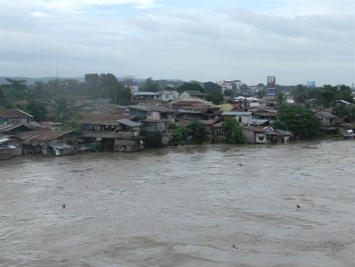
It’s now June and the rainy season has begun. Heavy rains are happening in some parts of the country. In other areas, floods follow after incessant rains.
Heavy rains and floods are two symptoms of La Niña. It is the exact opposite of the phenomenon called El Niño, which means “the Little Boy” or “Christ Child” in Spanish. La Niña, on the other hand, means “the Little Girl.” It is sometimes called “El Viejo,” “anti-El Niño,” or simply “a cold event” or a cold episode.
El Niño and La Niña occur every two to seven years and typically last for 9 to 12 months. Dr. Kevin Trenberth, an American distinguished senior scientist at the National Center for Atmospheric Research in Boulder, Colorado, warned: “El Nino extremes are greater, while La Nina lasts longer.”
La Niña is the exact opposite of the phenomenon called El Niño, which was originally recognized by fishermen off the coast of South America as the appearance of unusually warm water in the Pacific Ocean, occurring near the beginning of the year. El Niño means “the Little Boy” or “Christ Child” in Spanish. The name was used for the tendency of the phenomenon to arrive around Christmas.
La Niña, on the other hand, means “the Little Girl.” It is sometimes called “El Viejo,” “anti-El Niño,” or simply “a cold event” or a cold episode.
To simplify, meteorologists explain: El Niño and La Niña are opposite phases of the ENSO cycle, with La Niña sometimes referred to as the cold phase of ENSO and El Niño as the warm phase of ENSO.
“El Niño and La Niña result from interaction between the surface of the ocean and the atmosphere in the tropical Pacific,” the US National Oceanic and Atmospheric Administration (NOAA) explained. “Changes in the ocean impact the atmosphere and climate patterns around the globe. In turn, changes in the atmosphere impact the ocean temperatures and currents.”
In the tropics, global climate variations in La Niña tend to be opposite of those of El Niño. “If you expect drought in the country with El Niño because of reduced rainfall and less typhoons, there will be more than normal rainfall and the normal but ‘stronger typhoons’ during a La Niña episode that will cause floods and devastation of farms and property,” explains Dr. Rafael D. Guerrero III, an academician at the National Academy of Science and Technology.
To help the country prepare for the onslaught of the coming La Niña, the Department of Science and Technology (DOST) and Mapua University have recently launched a localized weather information and impact monitoring system called Localized Weather, Environment, and Hydromet Monitoring System (WEHLO).
“We believe that scientific advancements are not just about immediate responses to natural hazards and consequent disasters; they are about creating long-term solutions that reduce risks and promote sustainable development. As we face increasing disaster risks, we must move beyond traditional approaches and embrace innovations that provide solutions and open opportunities for a better tomorrow,” Solidum said.
The WEHLO was developed by the Mapua University School of Civil, Environmental, and Geological Engineering led by Dr. Francis Aldrine Uy. It is considered a Disaster Risk Reduction and Management (DRRM) technology.
The WEHLO is among the funded technologies by the DOST-Philippine Council for Industry, Energy, and Emerging Technology Research and Development (PCIEERD) under the Funding Assistance for Spin-off and Translation of Research in Advancing Commercialization (FASTRAC) Program. The PCIEERD has provided P15 million for the said project.
Unlike other existing weather monitoring systems in the country, WEHLO ensures that its System adheres to the international standard set by the UN World Meteorological Organization (WMO). In addition to this, the Project has improved the Automated Real-Time Monitoring System sensors with the Philippine Atmospheric, Geophysical and Astronomical Services Administration (PAGASA).
“One of the advantages of this technology is that we can modify the system based on the users’ needs which means, we can manually calibrate the system and provide localized weather data including rainfall, temperature, humidity, pressure, soil moisture, wind speed, wind direction, flow velocity, and water level,” explained Dr. Uy, WEHLO project leader and Chief Executive Officer of the USHER Technology Inc.
Project WEHLO has already deployed and established partnerships with the local government units of Infanta and General Nakar in the province of Quezon and Pantabangan and Angat in Bulacan.
The technology reportedly helps municipalities gather reliable and accurate real-time data with continuous data transmission even during inclement weather where mobile phone signals are often interrupted, and power outages occur.
“Innovative DRRM technologies like WEHLO play a crucial role in our disaster preparedness. As La Niña approaches, precise weather information really empowers municipalities and enhances disaster management,” said Enrico C. Paringit, PCIEERD Executive Director.
Meanwhile, some people are wondering how La Niña will affect the country’s weather? PAGASA has this answer: “Effects of La Niña could be manifested above the normal rainfall conditions in major parts of the country, particularly along the eastern sections. This is mainly due to more intense northeast monsoon and tropical cyclone activities.”
Whether La Niña will happen or not sooner, it would be best for everyone to start preparing for its occurrence. “It is better for the national government to prepare for another extreme weather event,” Anthony Joseph R. Lucero, chief of PAGASA’s Climate Monitoring and Prediction Section, was quoted as saying.
On the average, the Philippines experiences 20 typhoons every year. Reports from the country’s weather bureau said that as the El Niño weakens, the country may experience intensified rain as La Niña approaches the second semester of the year.
With La Niña, typhoons are expected to be more common and disastrous. “Potential adverse impacts of the developing La Niña include floods and landslides over vulnerable areas with varying magnitude,” the weather bureau warned.
“All concerned agencies are advised to take precautionary measures to mitigate the potential adverse impacts of the developing La Niña,” urged Dr. Vicente B. Malano, PAGASA administrator. “(We) will closely monitor these conditions and regular updates and advisories shall be issued as appropriate.”
Dr. Guerrero admitted that Filipino farmers cannot do anything against the onslaught of La Niña except to prepare and plan for it. “Planting in flood-prone areas should be avoided to avert crop losses,” he stressed. “Drainage and flood-control structures should be renovated beforehand.”
Health-wise, people are likely to suffer from La Niña. During floods, food-borne and water-borne diseases accelerate, according to the Department of Health (DOH). “Flooding can contaminate the public water through the disruption of water purification and sewage disposal systems, rupture of underground pipelines and storage tanks,” said the disaster management unit of DOH.


